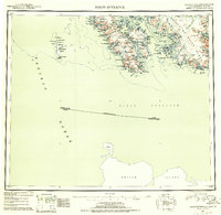
USGS Topo Quad Dixon Entrance, Alaska
Download Dixon Entrance
Download Dixon Entrance
Southern Latitude:
54.0000 N
Eastern Longitude:
-132.0000
Northen Latitude:
55.0000 N
Western Longitude:
-134.0000
Abandoned Towns(s) in Dixon Entrance
Howkan,
Klinkwan,
Archipelago(s) in Dixon Entrance
Bay Islands,
Area(s) in Dixon Entrance
Boat Rocks,
Cape Horn Rocks,
Egg Rock,
Guide Rocks,
North Rocks,
South Rocks,
Triplet Rocks,
Bar(s) in Dixon Entrance
Bird Rocks,
Brown Bear Rock,
Howkan Reef,
Mill Reef,
Pond Rock,
Shoe Rock,
Bay(s) in Dixon Entrance
Port Bazan,
American Bay,
Anchorage Cove,
Augustine Bay,
Biscuit Lagoon,
Bolles Inlet,
Brownson Bay,
Camp Cove,
Chickwan Bight,
Clam Cove,
Cleva Bay,
Coning Inlet,
Cordova Bay,
Datzkoo Harbor,
Dova Bay,
Eagle Harbor,
Elbow Bay,
Essowah Harbor,
Frederick Cove,
Gold Harbor,
Gooseneck Harbor,
Grace Harbor,
Ham Cove,
Hessa Inlet,
Hunter Bay,
Johnson Cove,
Kaigani Harbors,
Kassa Inlet,
Kendrick Bay,
Klakas Inlet,
Klinkwan Cove,
Liscome Bay,
Little Brownson Bay,
Little Daykoo Harbor,
Mabel Bay,
Max Cove,
McLean Arm,
McLeod Bay,
Minnie Bay,
Minnie Cutoff,
Mission Cove,
Natoma Bay,
Nichols Bay,
Nina Cove,
North Kaigani Harbor,
Pond Bay,
Rose Inlet,
Ruth Bay,
The Saitchuck,
Security Cove,
Shoe Inlet,
Short Arm Kendrick Bay,
South Arm Kendrick Bay,
South Arm Moira Sound,
South Kaigani Harbor,
Stone Rock Bay,
Tah Bay,
Touchit Cove,
Vesta Bay,
Waterfall Bay,
Welcome Cove,
West Arm Kendrick Bay,
West Arm Moira Sound,
West Arm Moira Sound,
Winter Bay,
Wolk Harbor,
Wood Cove,
Cape(s) in Dixon Entrance
Point Nunez,
Point Cornwallis,
Point Bazan,
Point Marsh,
Aurora Point,
Beak Point,
Cape Augustine,
Cape Chacon,
Cape Magdalena,
Cape Muzon,
Coning Point,
Corlies Point,
Datzkoo Point,
Davidson Point,
Dix Point,
Essowah Point,
Far Point,
Gooseneck Point,
Grave Point,
Gusdagane Point,
Kaigani Point,
Kassa Point,
Keg Point,
Leading Point,
Liscome Point,
Luke Point,
Mexico Point,
Middle Point,
Natoma Point,
Parrot Point,
Ritter Point,
Rockwell Point,
Rose Point,
Security Point,
Shipwreck Point,
Surf Point,
Tum Point,
Vesta Point,
Point Webster,
Welcome Point,
Whirlpool Point,
Wolk Point,
Channel(s) in Dixon Entrance
Bert Millar Cutoff,
Buschmann Pass,
Egg Passage,
Eureka Channel,
Hessa Narrows,
Howkan Narrows,
Jackson Passage,
Kaigani Strait,
Kelp Passage,
Little Pass,
The Narrows,
Rocky Pass,
Ruth Cutoff,
Ship Island Passage,
Thompson Passage,
Hill(s) in Dixon Entrance
Biscuit Knob,
Intun Cone,
Intungidi Hill,
Island(s) in Dixon Entrance
Abalone Island,
Anchor Island,
Aston Island,
Barbara Rock,
Barrier Islands,
Bean Island,
Black Rock,
Bushy Island,
Butler Rock,
Center Island,
Channel Islands,
Clump Island,
Crow Island,
Dall Island,
Datzkoo Islands,
Daykoo Islands,
Dead Pine Island,
Dewey Rocks,
Dolgoi Island,
Double Island,
Douglass Island,
Forrester Island,
Gourd Island,
Grand Island,
Grass Peak,
Grass Rock,
The Haystack,
Helen Island,
Hessa Island,
Jackson Island,
Kassa Island,
Klakas Island,
Lacey Island,
Long Island,
Lowrie Island,
Mabel Island,
Middle Island,
Parrot Rock,
Petrel Island,
Poe Island,
Rhea Rocks,
Round Island,
Round Islands,
Ruth Island,
Sea Lion Rock,
Seagull Island,
Ship Island,
Ship Islands,
Shoe Island,
South Rock,
Square Island,
Tah Island,
Turn Island,
Wallace Rock,
West Mill Rock,
White Rocks,
Lake(s) in Dixon Entrance
Essowah Lakes,
Hessa Lake,
Johnson Lake,
Little Devil Lake,
Nichols Lake,
Parrot Lake,
Lake Seclusion,
Waterfall Lake,
Lake Welcome,
Mountain(s) in Dixon Entrance
Bokan Mountain,
Cone Mountain,
Grace Mountain,
Nichols Mountain,
Stripe Mountain,
Twin Peaks,
Mount Vesta,
Pillar(s) in Dixon Entrance
Hattie Rock,
Stream(s) in Dixon Entrance
Perkins Creek,
Village(s) in Dixon Entrance
Long Island,
