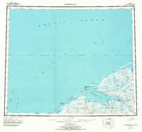
USGS Topo Quad Shishmaref, Alaska
Download Shishmaref
Download Shishmaref
Southern Latitude:
66.0000 N
Eastern Longitude:
-165.0000
Northen Latitude:
67.0000 N
Western Longitude:
-168.0000
Bay(s) in Shishmaref
Arctic Lagoon,
Arctic Lagoon,
Cowpack Inlet,
Shishmaref Inlet,
Cape(s) in Shishmaref
Cape Lowenstern,
City(s) in Shishmaref
Shishmaref,
Island(s) in Shishmaref
Egg Island,
Sarichef Island,
River(s) in Shishmaref
Arctic River,
Cowpack River,
North Fork Serpentine River,
Sanaguich River,
Sanaguich River,
Serpentine River,
South Fork Serpentine River,
Stream(s) in Shishmaref
Bonanza Creek,
Eldorado Creek,
Goose Creek,
Grayling Creek,
Lone Butte Creek,
Tin Creek,
Trout Creek,
Waterway(s) in Shishmaref
Arctic Ocean,