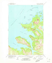
USGS Topo Quad Afognak B-3, Alaska
Download Afognak B-3
Download Afognak B-3
Southern Latitude:
58.2500 N
Eastern Longitude:
-152.6667
Northen Latitude:
58.5000 N
Western Longitude:
-153.0000
Bay(s) in Afognak B-3
Bluefox Bay,
Devil Inlet,
Devils Bay,
Foul Bay,
Paramanof Bay,
Pinnacle Rock,
Cape(s) in Afognak B-3
Black Cape,
Island(s) in Afognak B-3
Alligator Island,
Ban Island,
Bear Island,
Grassy Island,
Hogg Island,
Rocky Island,
Teck Island,
Lake(s) in Afognak B-3
Hidden Lake,
Mountain(s) in Afognak B-3
Devilpaw Mountain,
Dome Peak,