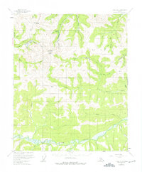
USGS Topo Quad Circle B-3, Alaska
Download Circle B-3
Download Circle B-3
Southern Latitude:
65.2500 N
Eastern Longitude:
-145.0000
Northen Latitude:
65.5000 N
Western Longitude:
-145.5000
Mountain(s) in Circle B-3
Mastodon Dome,
Pass(s) in Circle B-3
Eagle Summit,
River(s) in Circle B-3
Mastodon Fork,
Miller Fork,
Stream(s) in Circle B-3
Acme Creek,
Bender Pup,
Clums Fork,
Clums Fork Birch Creek,
Fortythree Pup,
Great Unknown Creek,
Harrison Fork,
Maiden Pup,
Mastodon Fork Eagle Creek,
McLean Creek,
Miller Fork Eagle Creek,
North Fork Harrison Creek,
Slate Creek,
South Fork Harrison Creek,
Thomas Creek,
Wolf Creek,
Trail(s) in Circle B-3
Pinnell Trail,
Valley(s) in Circle B-3
Baker Gulch,
Fortytwo Gulch,
Greenhorn Gulch,
Tinhorn Gulch,
