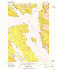
USGS Topo Quad Juneau A-1, Alaska
Download Juneau A-1
Download Juneau A-1
Southern Latitude:
58.0000 N
Eastern Longitude:
-134.0000
Northen Latitude:
58.2500 N
Western Longitude:
-134.3333
Abandoned Towns(s) in Juneau A-1
Sikanasankian,
Bar(s) in Juneau A-1
Cherokee Flats,
Bay(s) in Juneau A-1
Doty Cove,
Fool Inlet,
Green Cove,
King Salmon Bay,
Oliver Inlet,
Slocum Inlet,
Suicide Cove,
Taku Harbor,
Cape(s) in Juneau A-1
Arden Point,
Bishop Point,
Circle Point,
Cooper Point,
Cove Point,
False Arden,
Grave Point,
Greely Point,
Icy Point,
Point Salisbury,
Southeast End,
Stockade Point,
Tantallon Point,
Tantallon Point,
Dam(s) in Juneau A-1
Taku Cannery Dam,
Island(s) in Juneau A-1
Grand Island,
Marmion Island,
Lake(s) in Juneau A-1
Bart Lake,
Lieuy Lake,
Taku Lake,
Mountain(s) in Juneau A-1
Butler Peak,
Irving Peak,
Taku Mountain,
Williams Mountain,
Park(s) in Juneau A-1
Oliver Inlet State Marine Park,
Taku Harbor State Marine Park,
Stream(s) in Juneau A-1
Dorothy Creek,
Dupont Creek,
Grindstone Creek,
Little Sheep Creek,
Nevada Creek,
Rhine Creek,
Trail(s) in Juneau A-1
Point Bishop - Dupont Trail,
Valley(s) in Juneau A-1
Goldstein Gulch,
Village(s) in Juneau A-1
Taku Harbor,
Waterfall(s) in Juneau A-1
Grindstone Falls,