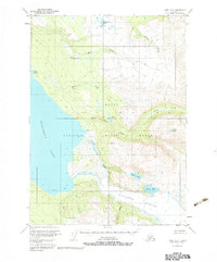
USGS Topo Quad Kenai A-2, Alaska
Download Kenai A-2
Download Kenai A-2
Southern Latitude:
60.0000 N
Eastern Longitude:
-150.3750
Northen Latitude:
60.2500 N
Western Longitude:
-150.7500
Bay(s) in Kenai A-2
Devils Bay,
Lake(s) in Kenai A-2
Arctic Lake,
Lake Emma,
Goldeneye Lake,
Green Lake,
Point Lake,
Timberline Lake,
Wolverine Lake,
Stream(s) in Kenai A-2
Clear Creek,
Crystal Creek,
Glacier Creek,
Indian Creek,
Moose Creek,
Truuli Creek,