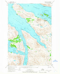
USGS Topo Quad Kodiak D-4, Alaska
Download Kodiak D-4
Download Kodiak D-4
Southern Latitude:
57.7500 N
Eastern Longitude:
-153.0000
Northen Latitude:
58.0000 N
Western Longitude:
-153.3333
Bay(s) in Kodiak D-4
Dry Spruce Bay,
Viekoda Bay,
Cape(s) in Kodiak D-4
Drying Point,
Gori Point,
Kupreanof Peninsula,
Naugolka Point,
Outlet Cape,
Perenosa Point,
Rolling Point,
Seiba Point,
Channel(s) in Kodiak D-4
Kupreanof Strait,
Uganik Passage,
Island(s) in Kodiak D-4
Bare Island,
Dry Spruce Island,
Mountain(s) in Kodiak D-4
Kupreanof Mountain,
