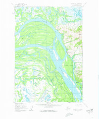
USGS Topo Quad Marshall D-1, Alaska
Download Marshall D-1
Download Marshall D-1
Southern Latitude:
61.7500 N
Eastern Longitude:
-162.0000
Northen Latitude:
62.0000 N
Western Longitude:
-162.3750
Abandoned Towns(s) in Marshall D-1
Uglovaia,
Cape(s) in Marshall D-1
Moonlight Point,
City(s) in Marshall D-1
Marshall,
Cliff(s) in Marshall D-1
The Bluff,
Island(s) in Marshall D-1
Arbor Island,
Nevensky Island,
Rose Island,
River(s) in Marshall D-1
Monarch Slough,
Wilson Creek Slough,
Slough(s) in Marshall D-1
Poltes Slough,
Stream(s) in Marshall D-1
Batto Creek,
Bud Creek,
Deep Creek,
First Chance Creek,
Hungry Creek,
Our Creek,
Owl Creek,
Pilcher Mountain Creek,
Spruce Creek,
Wilson Creek,
Village(s) in Marshall D-1
Ingrihak,
Takshak,