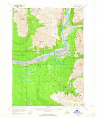
USGS Topo Quad McCarthy B-5, Alaska
Download McCarthy B-5
Download McCarthy B-5
Southern Latitude:
61.2500 N
Eastern Longitude:
-142.5000
Northen Latitude:
61.5000 N
Western Longitude:
-142.8750
Abandoned Towns(s) in McCarthy B-5
Nizina,
Skolai,
Sourdough,
Cape(s) in McCarthy B-5
Spruce Point,
Island(s) in McCarthy B-5
Squaw Island,
Lake(s) in McCarthy B-5
Baultoff Lakes,
Locale(s) in McCarthy B-5
Nizia,
Mine(s) in McCarthy B-5
Green Butte Mine,
Nikolai Mine,
Mountain(s) in McCarthy B-5
Porphyry Mountain,
Sourdough Peak,
Williams Peak,
Pass(s) in McCarthy B-5
Nikolai Pass,
Ridge(s) in McCarthy B-5
Sourdough Hill,
River(s) in McCarthy B-5
Chitistone River,
Stream(s) in McCarthy B-5
Boulder Creek,
Chititu Creek,
Dan Creek,
East Fork McCarthy Creek,
Lake Creek,
Lime Springs Creek,
May Creek,
Nikolai Creek,
Rex Creek,
White Creek,
Young Creek,
Trail(s) in McCarthy B-5
Bonanza Mine Road,
Jumbo Mine Trail,
Valley(s) in McCarthy B-5
Blygh Gulch,
Boulder Gulch,
Crumb Gulch,
Dry Gulch,
Grubstake Gulch,
Jolly Gulch,
Kaufman Gulch,
Kermon Gulch,
Pack Gulch,
Sawmill Gulch,
Sheep Gulch,
Sunday Gulch,
Virginia Gulch,
Village(s) in McCarthy B-5
May Creek,
