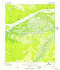
USGS Topo Quad Nulato C-1, Alaska
Download Nulato C-1
Download Nulato C-1
Southern Latitude:
64.5000 N
Eastern Longitude:
-156.0000
Northen Latitude:
64.7500 N
Western Longitude:
-156.5000
Bar(s) in Nulato C-1
Sandy Hook,
Cliff(s) in Nulato C-1
Sandstone Bluff,
Hill(s) in Nulato C-1
Mueller Mountain,
Island(s) in Nulato C-1
Dainty Island,
Yuki Island,
Locale(s) in Nulato C-1
Yokakek,
River(s) in Nulato C-1
Ruby Slough,
Yuki River,
Stream(s) in Nulato C-1
Gohn Creek,
Whiskey Creek,
