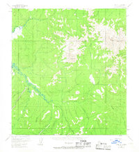
USGS Topo Quad Ophir A-1, Alaska
Download Ophir A-1
Download Ophir A-1
Southern Latitude:
63.0000 N
Eastern Longitude:
-156.0000
Northen Latitude:
63.2500 N
Western Longitude:
-156.5000
Mountain(s) in Ophir A-1
Cloudy Mountain,
Twin Mountain,
Stream(s) in Ophir A-1
Anvil Creek,
California Creek,
California Creek,
Canadian Creek,
Dome Creek,
Ganes Creek,
Goldbottom Creek,
Independence Creek,
Little Creek,
Ready Bullion Creek,
Roberts Creek,
Spruce Creek,
Yankee Creek,
Valley(s) in Ophir A-1
Victor Gulch,
Village(s) in Ophir A-1
Ganes Creek,
