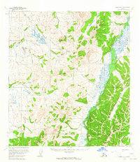
USGS Topo Quad Ophir B-2, Alaska
Download Ophir B-2
Download Ophir B-2
Southern Latitude:
63.2500 N
Eastern Longitude:
-156.5000
Northen Latitude:
63.5000 N
Western Longitude:
-157.0000
Mine(s) in Ophir B-2
Esperanto Placer Mine,
Mountain(s) in Ophir B-2
Caribou Mountain,
Madison Mountain,
Stream(s) in Ophir B-2
Bryan Creek,
Deep Creek,
Eldorado Creek,
Esperanto Creek,
Fourmile Creek,
Fourmile Creek,
Frisco Creek,
Frying Pan Creek,
Henry Creek,
Hurst Creek,
Iron Creek,
Mammoth Creek,
Wilson Creek,
