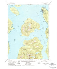
USGS Topo Quad Petersburg B-2, Alaska
Download Petersburg B-2
Download Petersburg B-2
Southern Latitude:
56.2500 N
Eastern Longitude:
-132.3333
Northen Latitude:
56.5000 N
Western Longitude:
-132.6667
Bar(s) in Petersburg B-2
City of Topeka Rock,
Bay(s) in Petersburg B-2
Circle Bay,
Deep Bay,
Fritter Cove,
King George Bay,
Mud Bay,
Roosevelt Harbor,
Shoemaker Bay,
Cape(s) in Petersburg B-2
Point Highfield,
Point Ancon,
Point Shekesti,
Cemetery Point,
East Point,
Middle Craig Point,
Neal Point,
Nemo Point,
Polk Point,
Reef Point,
Round Point,
South Craig Point,
Wedge Point,
Woronkofski Point,
Channel(s) in Petersburg B-2
Chichagof Pass,
Stikine Strait,
City(s) in Petersburg B-2
Wrangell,
Dam(s) in Petersburg B-2
Wrangell Lower Dam,
Wrangell Upper Dam,
Hill(s) in Petersburg B-2
Dewey Hill,
Island(s) in Petersburg B-2
Deadmans Island,
Drag Island,
Etolin Island,
Fivemile Island,
Hat Island,
Two Tree Island,
Vank Island,
Woronkofski Island,
Young Rock,
Lake(s) in Petersburg B-2
Kunk Lake,
Pats Lake,
Sunrise Lake,
Mountain(s) in Petersburg B-2
Ancon Peak,
Bessie Peak,
Chichagof Peak,
East Mountain,
Elephants Nose,
Helen Peak,
Red Mountain,
Sunrise Peak,
Sunset Peak,
Mount Woronkofski,
Stream(s) in Petersburg B-2
Institute Creek,
Kunk Creek,
McCormack Creek,
Pat Creek,