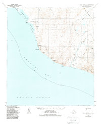
USGS Topo Quad Point Hope A-2, Alaska
Download Point Hope A-2
Download Point Hope A-2
Southern Latitude:
68.0000 N
Eastern Longitude:
-165.6000
Northen Latitude:
68.2500 N
Western Longitude:
-166.2000
Abandoned Towns(s) in Point Hope A-2
Ipnot,
Cape(s) in Point Hope A-2
Cape Thompson,
Crowbill Point,
Cliff(s) in Point Hope A-2
Agate Rock,
Artigotrat,
Augutaurak,
Imnakpak Cliff,
Hill(s) in Point Hope A-2
Akoviknak Mountain,
Angayukak Hill,
Flag Hill,
Guard Hill,
Iluituk Hill,
Inukpak Rock,
Mad Hill,
Stoney Ridge,
Telavirak Hills,
Lake(s) in Point Hope A-2
Akoviknak Lagoon,
Ikaknak Pond,
Kemegrak Lagoon,
Pumaknak Pond,
Ridge(s) in Point Hope A-2
Saligvik Ridge,
Stream(s) in Point Hope A-2
Agarak Creek,
Amaktusak Creek,
Angayukak Creek,
Bird Creek,
Conglomerate Creek,
Gulo Creek,
Ibrulikorak Creek,
Ikijaktusak Creek,
Imikrak Creek,
Isuk Creek,
Kiliguak Creek,
Kunuk Creek,
Mitik Creek,
Nasorak Creek,
Niyiklik Creek,
Ogotoruk Creek,
Pond Creek,
Snowbank Creek,
Tobit Creek,
Trail Creek,
Tumi Creek,
Ugalak Creek,
Valley(s) in Point Hope A-2
Ogotoruk Seavalley,
Ogotoruk Valley,
Village(s) in Point Hope A-2
Chariot,
