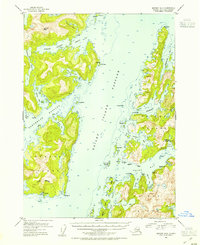
USGS Topo Quad Seward B-3, Alaska
Download Seward B-3
Download Seward B-3
Southern Latitude:
60.2500 N
Eastern Longitude:
-147.7500
Northen Latitude:
60.5000 N
Western Longitude:
-148.1250
Bay(s) in Seward B-3
Port Audrey,
Barnes Cove,
Cathead Bay,
Chenega Cove,
Copper Bay,
Drier Bay,
Eshamy Bay,
Granite Bay,
Johnson Bay,
Kake Cove,
Lower Herring Bay,
Mallard Bay,
Masked Bay,
Paddy Bay,
Cape(s) in Seward B-3
Point Nowell,
Cat Head,
Chenega Point,
Clump Point,
Ewan Point,
Herring Point,
Mallard Head,
Mountain Point,
Paddy Point,
Rocky Point,
Channel(s) in Seward B-3
Dangerous Passage,
Knight Island Passage,
Long Channel,
Island(s) in Seward B-3
Aguliak Island,
Channel Rock,
Chase Island,
Chenega Island,
Clam Islands,
Ewan Island,
Junction Island,
Mummy Island,
New Year Island,
New Year Islands,
Pass Island,
Range Island,
Rocky Island,
Squirrel Island,
Lake(s) in Seward B-3
Eshamy Lagoon,
Eshamy Lake,
Gunboat Lakes,
Rubber Boot Lake,
Mountain(s) in Seward B-3
Eshamy Peak,
Stream(s) in Seward B-3
Eshamy Creek,
