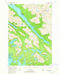
USGS Topo Quad Sitka D-7, Alaska
Download Sitka D-7
Download Sitka D-7
Southern Latitude:
57.7500 N
Eastern Longitude:
-136.0000
Northen Latitude:
58.0000 N
Western Longitude:
-136.3333
Bay(s) in Sitka D-7
Baker Cove,
Davison Bay,
Goulding Harbor,
Lisianski Inlet,
Little Bay,
Mirror Harbor,
Pelican Harbor,
Pinta Bay,
Stag Bay,
West Arm Mirror Harbor,
Cape(s) in Sitka D-7
Point Shultz,
Point Weigle,
Cape Dearborn,
Soloma Point,
Channel(s) in Sitka D-7
Dry Pass,
City(s) in Sitka D-7
Pelican,
Dam(s) in Sitka D-7
Pelican Creek Dam,
Flat(s) in Sitka D-7
Soloma Flat,
Island(s) in Sitka D-7
Cormorant Island,
Fairway Rock,
Fleming Island,
Grace Island,
Gull Rock,
Hill Island,
Junction Island,
Kinky Island,
Middle Island,
Pluma Island,
Snag Island,
Lake(s) in Sitka D-7
Lake James,
Lake Cunningham,
Lake Morris,
Duck Lake,
Lake Elfendahl,
Goose Lake,
Goulding Lake,
Goulding Lakes,
Otter Lake,
Lake Smiley,
Mine(s) in Sitka D-7
Apex Mine,
Cobol Mine,
El Nido Mine,
Golden Hand Apex Mine,
Mountain(s) in Sitka D-7
Apex Mountain,
Mount Baker,
Mount Barness,
Big Chief Mountain,
Mount Crowther,
Cub Mountain,
Mount Douglas,
Mount Drake,
Mount Fritz,
Goon Dip Mountain,
Mine Mountain,
Mineral Mountain,
North Mountain,
Pass Mountain,
Pegmatite Mountain,
Pinnacle Mountain,
Pinnacle Peak,
Mount Pinta,
Mount Raatikainen,
Wedge Mountain,
Pass(s) in Sitka D-7
Fleming Channel,
Sea Level Slough,
West Arm,
Pillar(s) in Sitka D-7
Shag Rock,
River(s) in Sitka D-7
Goulding River,
Lisianski River,
Saltery River,
Stag River,
Steelhead River,
Stream(s) in Sitka D-7
Cann Creek,
Falls Creek,
Pelican Creek,
Phonograph Creek,
Trail(s) in Sitka D-7
Mine Mountain Trail,
Village(s) in Sitka D-7
Sunnyside,