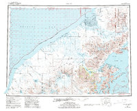
USGS Topo Quad Chignik, Alaska
Download Chignik
Download Chignik
Southern Latitude:
56.0000 N
Eastern Longitude:
-158.0000
Northen Latitude:
57.0000 N
Western Longitude:
-160.5000
Abandoned Towns(s) in Chignik
Kaluiak,
Unangashik,
Bar(s) in Chignik
Chignik Spit,
Bay(s) in Chignik
Port Heiden,
Anchorage Bay,
Boomers Cove,
Castle Bay,
Chignik Bay,
Chignik Lagoon,
Devils Bay,
East Bight,
Fishhook Bay,
Fishrack Bay,
Foot Bay,
Hook Bay,
Ivan Bay,
Jack Bay,
Kuiukta Bay,
Lake Bay,
Lumber Bay,
Mallard Duck Bay,
Mud Bay,
Mud Hole,
Necessity Cove,
Nikolai Cove,
Northwest Arm Castle Bay,
Portage Bay,
Ross Cove,
Schooner Bay,
Seal Bay,
Sweater Bay,
Warner Bay,
Windy Bay,
Cape(s) in Chignik
Browns Point,
Cape Kutuzof,
Cape Seniavin,
Castle Cape,
Diamond Point,
Green Point,
Hume Point,
Jack Point,
Jerrys Point,
Mensis Point,
Packers Point,
Pilerack Point,
Rabbit Point,
Rocky Point,
Strogonof Point,
Tuliumnit Point,
City(s) in Chignik
Chignik,
Cliff(s) in Chignik
Chignik Head,
Negro Head,
Crater(s) in Chignik
Aniakchak Crater,
Dam(s) in Chignik
Alaska Packers Association Chignik Dam,
Columbia Wards Fisheries Incorporated Dam,
Peter Pan Seafoods Chignik Dam,
Flat(s) in Chignik
Chignik Flats,
Glacier(s) in Chignik
Cone Glacier,
Crab Glacier,
Finger Glacier,
Fog Glacier,
Harpoon Glacier,
Island Glacier,
Outlet Glacier,
Slim Glacier,
Hill(s) in Chignik
Rifle Butte,
Island(s) in Chignik
Anguvik Island,
Chankliut Island,
Chignik Island,
Chistiakof Island,
Eagle Rock,
Scottys Island,
Seal Islands,
Three Sisters Rock,
Lake(s) in Chignik
Bear Lake,
Black Lake,
Chignik Lake,
Goldfish Lake,
Hendrickson Lake,
Ilnik Lake,
Purple Lake,
Sandy Lake,
Surprise Lake,
Sven Lake,
Wildman Lake,
Mountain(s) in Chignik
Aniakchak Peak,
Big Butte,
Black Nose,
Black Peak,
Chignik Mountain,
Half Cone,
Knife Peak,
Mount Kupreanof,
Range Peak,
Red Peak,
Ship Mountain,
Mount Veniaminof,
Vent Mountain,
Virgin Peak,
Weasel Mountain,
Pass(s) in Chignik
Black Pass,
The Gates,
Portage Pass,
Range(s) in Chignik
Three Hills,
Ridge(s) in Chignik
The Garden Wall,
River(s) in Chignik
Alec River,
Bear River,
Bear River,
Chignik River,
Clark River,
Ilnik River,
King Salmon River,
Meshik River,
Milky River,
Muddy River,
Ocean River,
Sandy River,
Unangashak River,
West Fork Chignik River,
Stream(s) in Chignik
Abbot Creek,
Abbott Creek,
Alfred Creek,
Ash Creek,
Barabara Creek,
Bear Creek,
Bearskin Creek,
Birthday Creek,
Black Creek,
Blue Violet Creek,
Blueberry Creek,
Bluff Creek,
Boulevard Creek,
Braided Creek,
Broad Creek,
Cathedral Creek,
Charles Creek,
Chiaktuak Creek,
Conglomerate Creek,
Crater Creek,
Cub Creek,
Cucumber Creek,
Dago Frank Creek,
Dry Creek,
Fan Creek,
Fireweed Creek,
Fog Creek,
Fracture Creek,
Highland Creek,
Home Creek,
Hook Creek,
Landlocked Creek,
Marshinlak Creek,
Metrofania Creek,
Milk Creek,
Neketa Creek,
Old Ladies Creek,
Packers Creek,
Parallel Creek,
Plenty Bear Creek,
Rainbow Creek,
Rapid Creek,
Red Bluff Creek,
Rudy Creek,
Shoe Creek,
Sleepy Creek,
Spoon Creek,
Thompson Creek,
Through Creek,
Waterfall Creek,
Whalers Creek,
Wind Creek,
Wolf Creek,
Yellow Bluff Creek,
Valley(s) in Chignik
Bearskin Gulch,
McKinsey Valley,
Thompson Valley,
Village(s) in Chignik
Chignik Lagoon,
Chignik Lake,
Meshik,
Port Heiden,
