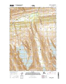
USGS Topo Quad Valdez A-5 SW, Alaska
Download Valdez A-5 SW
Download Valdez A-5 SW
Southern Latitude:
61.0000 N
Eastern Longitude:
-145.6875
Northen Latitude:
61.1250 N
Western Longitude:
-145.8750
Abandoned Towns(s) in Valdez A-5 SW
Wortmanns,
Flat(s) in Valdez A-5 SW
Dutch Flat,
Glacier(s) in Valdez A-5 SW
Glacier G214175E61036N,
Glacier G214199E61016N,
Wortmanns Glacier,
Ice Climbing Route(s) in Valdez A-5 SW
Angel,
Fast Friends,
Secret Journey,
Spring Loaded,
Stem City,
Tokyo Express,
Tsuri Gane,
Lake(s) in Valdez A-5 SW
Blueberry Lake,
Locale(s) in Valdez A-5 SW
19 Mile Wall,
Fracture Canyon,
Park(s) in Valdez A-5 SW
Blueberry Lake State Recreation Site,
Peak(s) in Valdez A-5 SW
Bronto,
Stone Mountain,
Whistlers Mother,
Stream(s) in Valdez A-5 SW
Bear Creek,
Bench Creek,
Sheep Creek,
Wortmanns Creek,
Valley(s) in Valdez A-5 SW
Heiden Canyon,