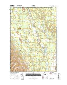
USGS Topo Quad Tyonek C-2 SW, Alaska
Download Tyonek C-2 SW
Download Tyonek C-2 SW
Southern Latitude:
61.5000 N
Eastern Longitude:
-150.5625
Northen Latitude:
61.6250 N
Western Longitude:
-150.7500
Area(s) in Tyonek C-2 SW
Nilq-aghedlen Kaq-,
Q-eyses Kaq-,
Flat(s) in Tyonek C-2 SW
Ken Ka-a,
Island(s) in Tyonek C-2 SW
Qa-itsusi,
Lake(s) in Tyonek C-2 SW
Otter Lake,
Q-eyses Bena,
T-eghes Untnu Bena,
Yensus Lake,
Ridge(s) in Tyonek C-2 SW
Trail Ridge,
Stream(s) in Tyonek C-2 SW
Anderson Creek,
Kala Ch-aq-a Betnu,
Lower Sucker Creek,
Trail Creek,