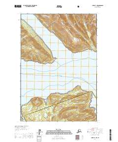
USGS Topo Quad Juneau A-1 NW, Alaska
Download Juneau A-1 NW
Download Juneau A-1 NW
Southern Latitude:
58.1250 N
Eastern Longitude:
-134.1667
Northen Latitude:
58.2500 N
Western Longitude:
-134.3333
Abandoned Towns(s) in Juneau A-1 NW
Sikanasankian,
Bar(s) in Juneau A-1 NW
Cherokee Flats,
Bay(s) in Juneau A-1 NW
Green Cove,
Cape(s) in Juneau A-1 NW
Arden Point,
Cove Point,
False Arden,
Icy Point,
Point Salisbury,
Southeast End,
Tantallon Point,
Tantallon Point,
Island(s) in Juneau A-1 NW
Marmion Island,
Stream(s) in Juneau A-1 NW
Dupont Creek,
Grindstone Creek,
Little Sheep Creek,
Nevada Creek,
Rhine Creek,
Trail(s) in Juneau A-1 NW
Point Bishop - Dupont Trail,
Valley(s) in Juneau A-1 NW
Goldstein Gulch,
Waterfall(s) in Juneau A-1 NW
Grindstone Falls,