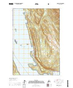
USGS Topo Quad Juneau B-3 NE, Alaska
Download Juneau B-3 NE
Download Juneau B-3 NE
Southern Latitude:
58.3750 N
Eastern Longitude:
-134.6667
Northen Latitude:
58.5000 N
Western Longitude:
-134.8333
Bar(s) in Juneau B-3 NE
Cohen Reef,
Eagle Reef,
Bay(s) in Juneau B-3 NE
Amalga Harbor,
Auke Nu Cove,
Eagle Harbor,
Huffman Harbor,
Lena Cove,
Pearl Harbor,
Tee Harbor,
Cape(s) in Juneau B-3 NE
Auke Cape,
Inspiration Point,
Point Lena,
Point Stephens,
Cliff(s) in Juneau B-3 NE
The Breadline,
Island(s) in Juneau B-3 NE
Aaron Island,
Cohen Island,
Kishbrock Island,
Lake(s) in Juneau B-3 NE
Peterson Lake,
Salt Lake,
Mine(s) in Juneau B-3 NE
Peterson Mine,
Windfall Creek Mine,
Mountain(s) in Juneau B-3 NE
Auke Mountain,
Treasury Hill,
Park(s) in Juneau B-3 NE
Auke Recreation Area,
Stream(s) in Juneau B-3 NE
Goose Creek,
Lena Creek,
Peterson Creek,
Shrine Creek,
Slate Creek,
Tee Creek,
Tenk Creek,
Tusta Creek,
Trail(s) in Juneau B-3 NE
Montana Creek Trail,
Spaulding Trail,
Valley(s) in Juneau B-3 NE
Prairie Basin,
Village(s) in Juneau B-3 NE
Dobson Landing,
Fairhaven,
Lena Beach,
Saint Terese,
Tee Harbor,
