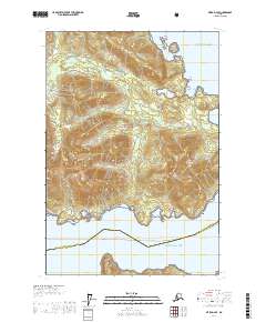
USGS Topo Quad Sitka D-4 SE, Alaska
Download Sitka D-4 SE
Download Sitka D-4 SE
Southern Latitude:
57.7500 N
Eastern Longitude:
-135.0000
Northen Latitude:
57.8750 N
Western Longitude:
-135.1667
Bay(s) in Sitka D-4 SE
Cedar Cove,
Coffee Cove,
Fin Cove,
Pavlof Harbor,
Sunshine Cove,
Cape(s) in Sitka D-4 SE
Cannery Point,
Columbia Point,
East Point,
Hill Point,
Sunny Point,
West Point,
Island(s) in Sitka D-4 SE
Cedar Island,
Little Cedar Island,
Pinnacle Rock,
Lake(s) in Sitka D-4 SE
Pavlof Lake,
Mountain(s) in Sitka D-4 SE
Mount Parish,
River(s) in Sitka D-4 SE
Pavlof River,
Salmon River,
Stream(s) in Sitka D-4 SE
Harley Creek,
Small Creek,
Village(s) in Sitka D-4 SE
Cannery,